On this page
What DataDelivery is
DataDelivery is an online platform that turns the photos your drone takes into professional map products. It runs entirely in your web browser — there’s nothing to download or install. You sign in, upload the photos your drone captured of a site, and the platform stitches and processes them into maps and 3D models you can measure, mark up, and share with your clients.
Here’s what you can make from a single set of drone photos:
- A stitched map — an orthophoto (a single, flat, map-accurate photo of the whole site, stitched together from all your individual drone images).
- 3D point clouds and models — a 3D version of the site you can spin around and fly through.
- Contour lines — the curved lines on a topographic map that connect points of equal elevation.
- Measurements — distance, height, and area measurements.
- Stockpile Measurements — for example, the volume of a stockpile (a pile of material like gravel or dirt).
- Marked-up images — photos with notes and shapes drawn on them to point out features or problems. Usually used in inspection workflows.
- Shareable reports — a clean web page you can send to a client to show off the results.
If you’ve never used drone data management software before, don’t worry — this guide walks you through every step, and the rest of this page gives you the mental model and vocabulary so everything else clicks into place.
The big picture: how it all fits together
No matter what your end goal is, every project follows the same five steps. Once this sequence makes sense, the whole platform makes sense:
- Create a job — set up a project for one site.
- Upload photos — drag your drone images into that job.
- Process — let the platform turn those photos into map products.
- View, measure & annotate — explore the results, take measurements, and add notes.
- Share — send your client a polished report.
A few words in that list have specific meanings in DataDelivery. Learn these five and you’ll never feel lost:
- Job — a project for one site or property. Everything about that site lives inside its job.
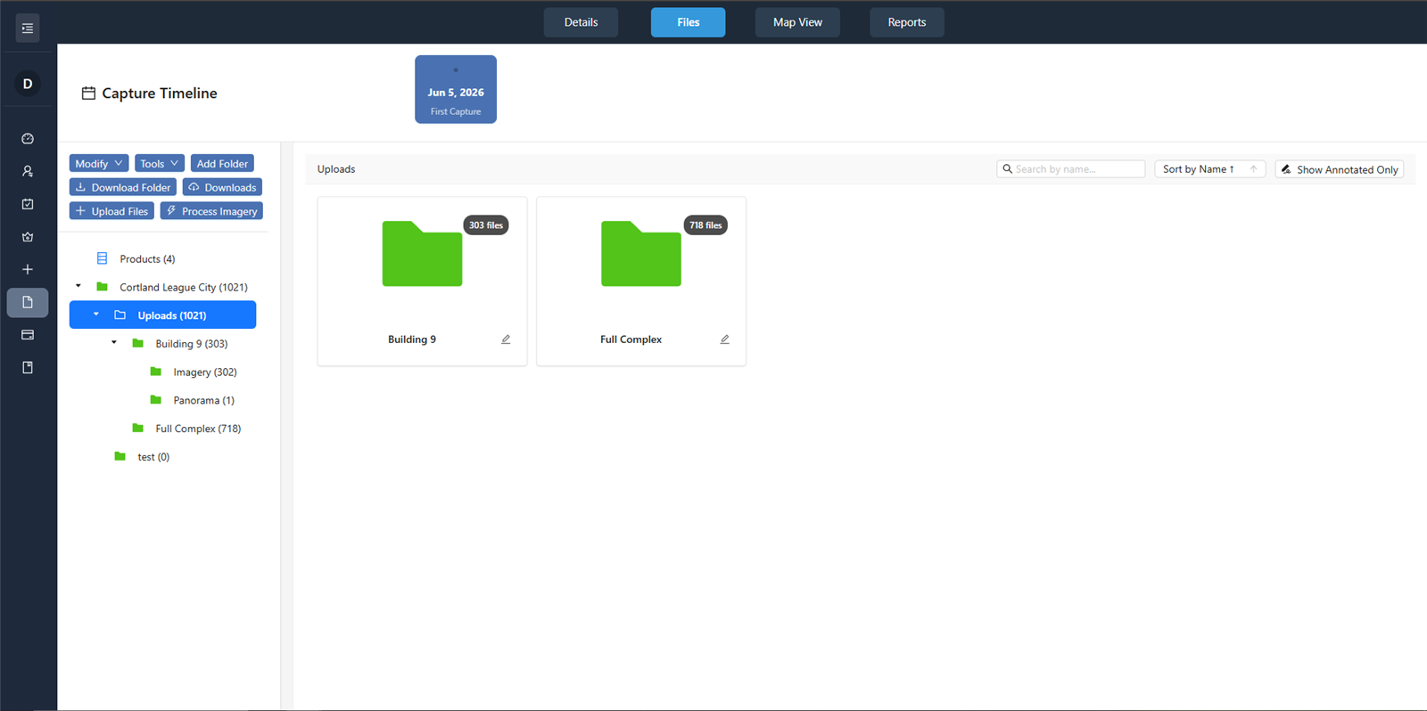
- Capture — one dated visit to that site. If you fly the same property again next month, that’s a second capture inside the same job — which lets you compare the site over time.
- Files and folders — your uploaded photos, organized in folders inside a capture, just like on your computer.
- Products (or deliverables) — the finished outputs the platform makes from your photos: the orthophoto, point cloud, and so on.
- Report — a shareable web page you can build to present results to your client.
Key words you’ll see
You’ll meet these terms all over the platform. Here’s a one-line plain-English definition of each — you can come back to this list any time:
- Job — a project for one site; the container for everything about that location.
- Capture — one dated visit (flight) of a site; multiple captures let you track changes over time.
- Orthophoto — a single flat, map-accurate photo of the whole site, stitched from all your images.
- Point cloud — a 3D model made of millions of colored dots that recreate the site in three dimensions.
- DSM — a Digital Surface Model: an elevation map of the very top surface, including buildings, trees, and equipment.
- DTM — a Digital Terrain Model: an elevation map of the bare ground, with buildings and trees removed.
- Contours — lines on a map connecting points of equal elevation, like a topographic map.
- Annotation — a note, marker, or shape you draw on an image or map to point something out.
- Report — a shareable web page that presents your results to a client.
- Storage — the online disk space your uploaded files and products take up; your plan sets the limit.
Want the complete list? See the full glossary on the FAQ page.
An honest note about accuracy
Before you go further, one important thing to understand — and it’s worth saying up front:
Warning: DataDelivery’s outputs are great for visualization, communication, rough measurements, and tracking progress over time. Measurements are approximate and are not a substitute for a licensed surveyor. Do not use them for engineering, legal, or property-boundary decisions. Any figures you may see later (such as GPS error or CE90/LE90 values) are statistical residuals, not an accuracy guarantee.
With that out of the way, let’s get you signed up.
Create your account
Creating your account is free and quick — you can sign in and start using the platform immediately. It only takes a minute, and there’s no email verification step to wait on.
Open the app. Go to app.nationaldroneservices.net and click Create Account. (If you’re on the main website instead, click the Start Free button — it opens the same sign-up form.)
Fill in your details. Type your Email, First Name, Last Name, and a Password. As you type the password, five live rules light up green — your password must have at least 8 characters, one uppercase letter, one lowercase letter, one number, and one special character (like ! or #). Then retype it in Confirm Password.
Agree and register. Check the box for I agree to the Terms of Service and Privacy Policy, then click the button to create your account.
You’ll know it worked when… you see Registration successful! You can now log in. — your account is ready and there’s no email to confirm.
Log in
What this is: signing in to the account you just created.
Enter your credentials. On the login screen, type your Email and Password.
Sign in. Click Submit.
Forgot your password?
Start the reset. On the login screen, click Forgot Password? Click here to reset.
Request a reset link. Type the email on your account and click Send Reset Link, then check your inbox.
Note: For your security, the screen always says a reset link was sent — even if no account uses that email. If nothing arrives, double-check you typed the exact address you signed up with.
Tip: Too many wrong attempts in a row triggers a short, temporary lockout — the button shows Wait (Ns) and counts down. Just wait for the timer to finish, then try again.
You’ll know it worked when… the app loads and you’re taken to your dashboard, with the sidebar visible on the left.
Your first few minutes
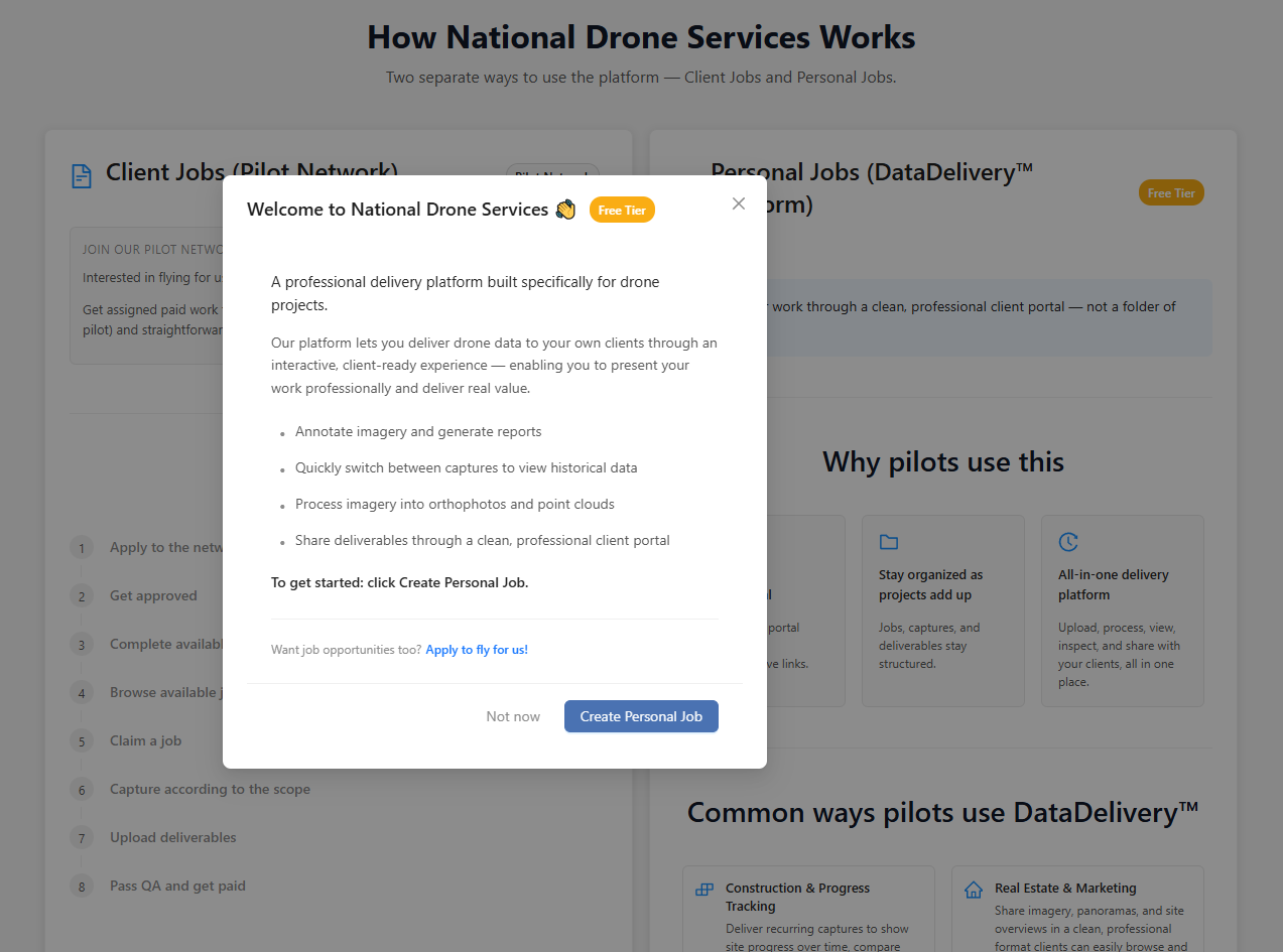
The first time you sign in, a welcome window pops up that says Welcome to National Drone Services 👋 with a Create Personal Job button. That button is the fastest way to start your very first project — but before you create a job, you’ll want to pick a plan (covered next).
Look at the left sidebar. You’ll see a Personal Jobs section — this is your home base. It contains:
- Memberships — choose or manage your plan.
- Create Personal Job — start a new project.
- My Personal Jobs — the list of all your projects.
- Annotation Glossary — your reusable library of mark-up labels (you’ll use this later when annotating).
Everything in this guide happens inside Personal Jobs, so it’s worth getting comfortable with where it lives.
What’s next? First, pick a plan that fits how much you’ll use the platform — see Plans, Storage & Billing. Then create your first project in Creating & Organizing Jobs.
Next: Plans, Storage & Billing
Pick the right membership and understand your monthly limits and storage before you build your first job.
Read guide →Related: How to Deliver Drone Data to Clients
Email, file transfers or a client portal: which fits each deliverable.
Read more →Was this page helpful?
Thanks for the feedback! It helps us improve the guide.
Still stuck?
We’re happy to help — email us and a real person will get back to you.
contact@nationaldroneservices.net