Give Construction Teams a Clear View of Site Progress
Fly a site on a regular schedule and deliver every visit in one client-facing portal. DataDelivery by National Drone Services organizes recurring drone captures by date, so owners, contractors, and project managers can review maps, photos, and reports — and compare progress between any two dates.
No credit card required. No-login links for stakeholders, including on the Free plan.
What is a construction progress portal?
A construction progress portal is a single client-facing page that organizes recurring drone captures of a site by date, so stakeholders can review and compare progress over time. Instead of emailing a separate folder after every flight, you add each visit to one ongoing project. Owners, contractors, developers, and project managers open the portal in a browser and follow the site as it changes — capture by capture.
In DataDelivery, the portal is generated from the job you already organized. Each flight becomes a date-stamped capture, and the orthomosaics, photos, 360° aerial panoramas, measurements, annotations, and reports for every visit live together in one place. Because the portal runs under your branding and (on higher plans) your own domain, the delivery looks like a finished product from your business.
Organize repeat flights by date
Every visit to a construction site belongs to the same project — not a new folder you have to track down later.
Captures organized by flight date
Each flight becomes a date-stamped capture inside the job, organized chronologically so the timeline reads clearly from first visit to most recent.
Add a capture each visit
When you re-fly the site, add a new capture to the existing job. No need to start over — the project simply gains another dated visit.
History accumulates in one place
The full project history builds up under one portal, so stakeholders always have the complete record of the site without hunting across separate deliveries.
Compare progress over time
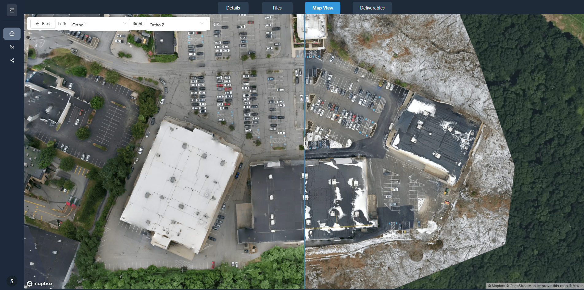
The whole point of recurring captures is seeing what changed. Stakeholders you invite can compare any two orthomosaics with a before and after slider and see the site change between visits.
- Choose any two capture dates to compare.
- Compare two point clouds from different visits side by side in the 3D viewer.
- Annotations mark site conditions and notes in context.
- Measurements on the imagery give area and distance reference.
Everything stakeholders need, in one portal
A DataDelivery job holds the deliverables a construction client expects, all organized by capture date.
Orthomosaics
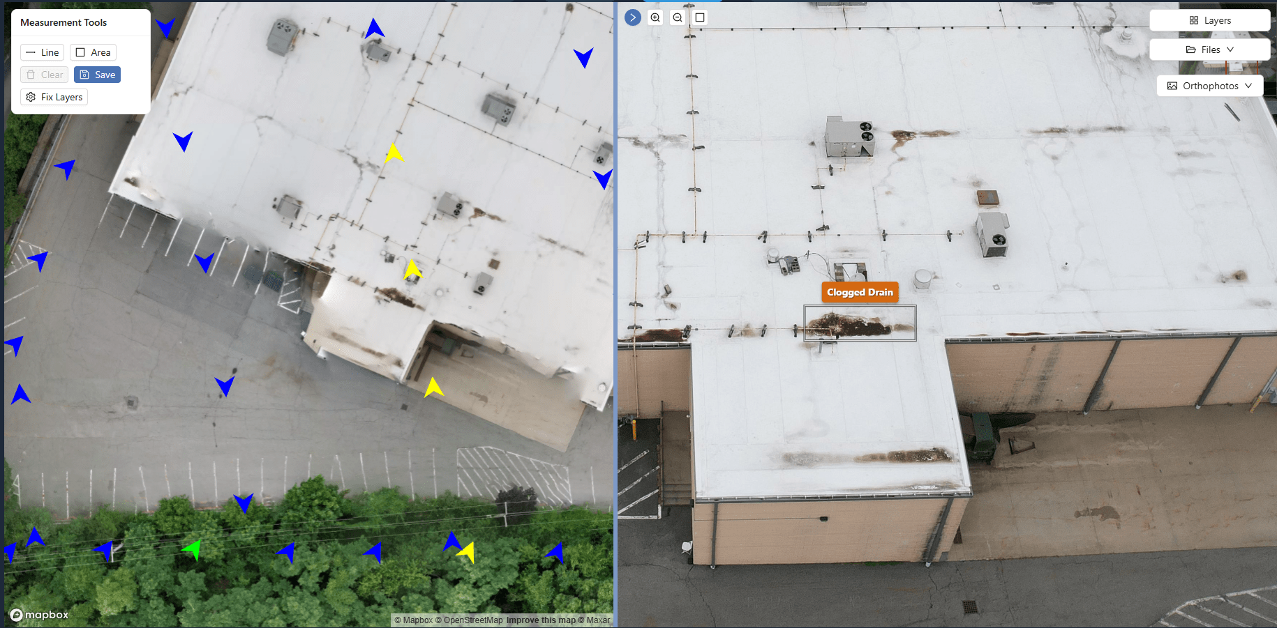
Georeferenced orthomosaics on an interactive map with zoom, pan, and measurement tools for every capture date.
Progress photos
Standard images and MP4 video from each visit, viewable in the browser so the client can browse the site visually.
360° aerial panoramas
Immersive aerial panoramas that let stakeholders look around the site from above for each capture.
Reports
Interactive web reports you build from the job's data, each with its own no-login link you can switch off.
Measurements
Measure distance, area and perimeter on the map, save them as named layers for each site visit, and export each layer as GeoJSON. Figures are approximate.
Annotations
Mark issues and add notes directly on the imagery so site conditions are documented in context.
Built for site stakeholders, on or off site
Anyone who needs to follow the project can review it from anywhere, and you stay in control of who has access.
No-login link
Send one URL. Stakeholders open the portal in a browser — no account, no install.
Control access
Share a job through a link you control, and revoke access at any time.
Access per person
Invite each stakeholder by email with their own permission level, from Viewer to Full access, and change or remove it any time.
Remote site review
Stakeholders review the site from the office or the field, without a trip to the project.
Note: Measurements are approximate and are not a substitute for a licensed surveyor. DataDelivery outputs suit visualization, documentation and progress monitoring, not engineering, legal or boundary decisions.
The recurring monitoring workflow
A repeatable cycle that keeps the construction portal current visit after visit.
-
1
Capture the site on a regular schedule
Fly the project on a recurring cadence so each visit documents another point in the build.
-
2
Process or organize the deliverables
Process orthomosaics and point clouds and organize the photos, panoramas, and files for the visit.
-
3
Add each capture to the project timeline
Add the new visit as a dated capture inside the existing job so the timeline stays in order.
-
4
Publish maps, imagery, reports, and files
Make the orthomosaics, imagery, reports, and project files available in the portal.
-
5
Share access with project stakeholders
Send the no-login link to owners, contractors, developers, and project managers.
-
6
Compare progress over time
Stakeholders you invite compare any two orthomosaics with a before and after slider to see what changed.
-
7
Maintain a documented project history
Every capture stays in the portal, building a documented record of the project over its life.
Who follows a site through the portal
Construction stakeholders who need to understand site progress — not just store files.
Owners
Watch the build advance between visits without needing to be on site.
General contractors
Document conditions, track progress, and keep one shared record of the site.
Developers
Follow project milestones with a clear visual timeline they can share.
Project managers
Compare dates and review annotated imagery to stay on top of the schedule.
See a live sample report
Open a live sample report, exactly as your construction stakeholders would see it. Every interface shown on this page is the actual platform.
Frequently asked questions
How do recurring captures work?
Each job is organized into captures by flight date. When you fly the site again, you add a new capture to the existing job, and it is date-stamped and organized chronologically. The whole project history accumulates in one place instead of being split across separate folders or jobs.
Can stakeholders compare two capture dates?
Yes. Stakeholders you invite can compare two capture dates, so an owner, contractor, or project manager can see how the site changed between visits. This is the core of progress monitoring in DataDelivery.
Do stakeholders need a login?
No. You can send a no-login link, including on the Free plan, and stakeholders open it in a browser with no account. Only you, the drone service provider, need a DataDelivery account. You control access and can revoke a link at any time.
What can I include for a construction client?
Orthomosaics on a map, progress photos and video, 360° aerial panoramas, point clouds, measurements, annotations, and client-ready reports. Each of these can be organized by capture date so the client follows the project over time.
Can different stakeholders get different access?
Yes. Invite each stakeholder by email and give them their own permission level: Viewer (view and download), Contributor, Editor or Full access. You can change or remove someone's access at any time. A no-login link is not a per-person view: it covers the files, maps and imagery from every dated site visit.
Keep exploring DataDelivery
Stockpile measurement platform
Measure stockpile volumes from drone imagery and deliver the results to clients.
Share orthomosaics with clients
Deliver georeferenced orthomosaics on an interactive map instead of giant files.
Drone client portal
Deliver any drone project through a professional, branded client portal.
DroneDeploy alternatives
Pricing, strengths and the options worth comparing in 2026.
Give your construction clients a clear view of progress
Start free, organize recurring captures by date, and send stakeholders a no-login link they can actually use.
Free plan — no credit card required.